One interesting software release I never had was the Australian Graphic Atlas software for Amiga. It is interesting to me since it was written in Australia, about Australia, for the Amiga. Perhaps people overseas have never seen this software before.

I finally managed to secure a copy this year, and thought I would take a look on my A3000, now that I have returned from my trip to Japan.
BTW You can look forward to a train blog entry about the luxury train called Shiki Shima (that I rode while there) very soon!
I discovered that the Australian Graphic Atlas software needs Amiga Vision installed as a prerequisite, which meant finding a copy of that also!
That proved harder and took a while to find a copy from the US. First time I have ever got some commercial Amiga software that NEEDED Amiga Vision to work! Do you know of any others?

Amiga Vision was distributed with Amiga 3000 systems when you bought one back in the day and requires Workbench 2.0 as a minimum.
Because my A3000 was second hand, unfortunately it didn't come with Amiga Vision.
I suppose you could buy it separately also, since I have this boxed version of Amiga Vision I sourced from the US:

If you want to learn more about how I built this super kickstart A3000 from scratch, (or just want to learn about super kickstarts) I did a 3 part series on this blog here:
Once Amiga Vision was installed from the floppy disks, I then installed Australian Graphic Atlas, which comes on 6 floppy disks.

As it is, there is still quite a bit to look at here - below if the main menu of Australian Graphic Atlas once run:

Having an electronic version of this type of information on your computer was rare.

You could also view rail network information, major roads and other geographical information like rainfall, population, etc.

Also Sydney is located higher than shown in the map.
The road network (main highway roads of course) shows how much of the outback desert areas of Australia in the middle is not covered.
There are dirt roads for those adventurous people which want to explore outback areas, but it is dangerous and potentially life threatening if anything goes wrong - there is nothing out there.
Really. Nothing.
A number of people (foreign tourists mainly) die out there each year due to car breakdowns and insufficient emergency supplies to survive until someone hopefully realises you are missing. There is no mobile signal, no fuel stations, no food stops, no repair places, and no significant towns for many hundreds of kilometres. Australia is a big country.
Building infrastructure like modern internet and mobile networks in this country is complicated by the sheer size, and that most people live on the coastline major cities.


Gatcha machines (or capsule toy machines in western countries) are big business in Japan - there are so many to choose from. How many? A lot - here is just one store I went to in Toyama full of hundreds of these gatcha machines:


It even includes micro sized cassettes for the tape deck (cassette decks open up), stereo cables for the speakers, and a record for the record player, which opens up too (as shown above). I love these detail things in Japan, you would never see something like this in Australia.


Anyway, enough about that - but it is cool though right? I thought so too. :-)
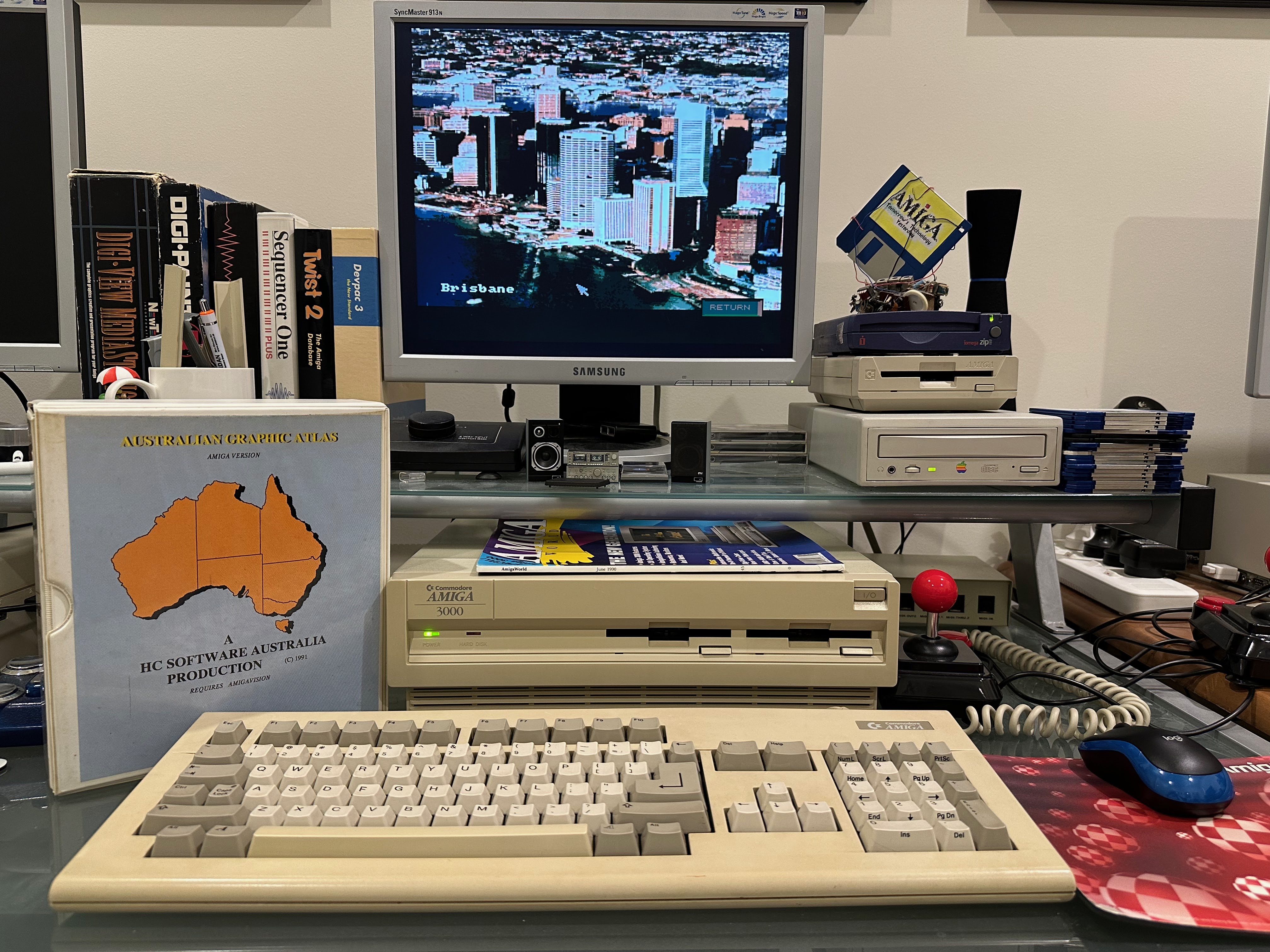
Back to the Australia Graphic Atlas now! You also get the option win the software to view the major city layout maps. Here is Adelaide, my home city:


You can select any of them to see more information about them - like Bob Hawke below.

It doesn't mention it above, but he was originally born in Bordertown, a small town in South Australia.
I was living in Alice Springs and Perth when he was Prime Minister.
Personally I thought he was mainly famous in Australia for his ability to down a schooner in one gulp very fast and his comment that "Anyone who fires a worker for taking off work today is a bum" comment after Australia won the Americas Cup yacht race in 1983.
You can see a brief best of Bob Hawke video here if you want to see that.
My history knowledge is clouded by a lack of interest in politics generally!


You can also lookup Australian postcodes in the software, which is probably the most useful feature, since posting letters was more common then and it was harder to find out postcodes without the internet - you had to visit a post office to find out back then!
Beyond that, it is just a curiosity that doesn't provide a lot of useful information these days. But I am glad to finally try Australian Graphic Atlas out on my Amiga in 2023.